
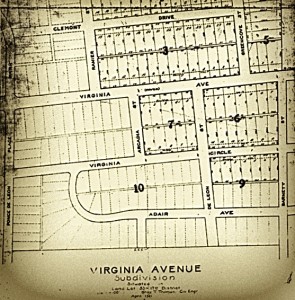
About a year ago, we posted 22 historic plat maps of various subdivisions that are now part of Virginia-Highland — these are the maps on which surveyors originally plotted how the land was subdivided into the lots that, for the most part, still exist today. To explore the maps, you can start by viewing the…
by John Wolfinger Thanx to Jenifer Keenan for bird-dogging Atlanta Public Works til they got this triangle cleared of all the weedy vegetation making the Virginia Avenue bridge sidewalk safely walkable and making it safer to pull out from Kanuga onto Monroe.
Download entire issue as PDF (5.3 MB)