
1928 maps now online (and many more)
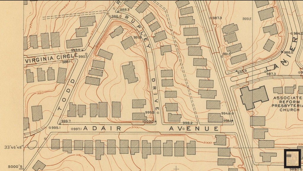
Historic maps lovers rejoice! A 1928 detailed topographic survey of Atlanta is now available online and includes Virginia-Highland roughly from Inman School on south. Our new Historic Maps page provides you the links. For future reference, the Historic Maps page is linked from our site’s menu under “Planning/Variances” and then “Preservation/History”, as well as from the A-Z index.
The new page also links you to our amazing collection of original plat maps from the era that VaHi’s subdivisions were built; the 1949 aerial survey; and the 1911 and 1920 Sanborn fire maps.
For those with an interest in Atlanta’s history before VaHi existed, an entire 1878 city atlas was also recently made available online. We can also direct you to the full resolution version of the beautiful 1871 “bird’s eye view” illustration of Atlanta.